Aerial Drone Services
Aerial Land Photography — Showcase Every Acre in Stunning Detail
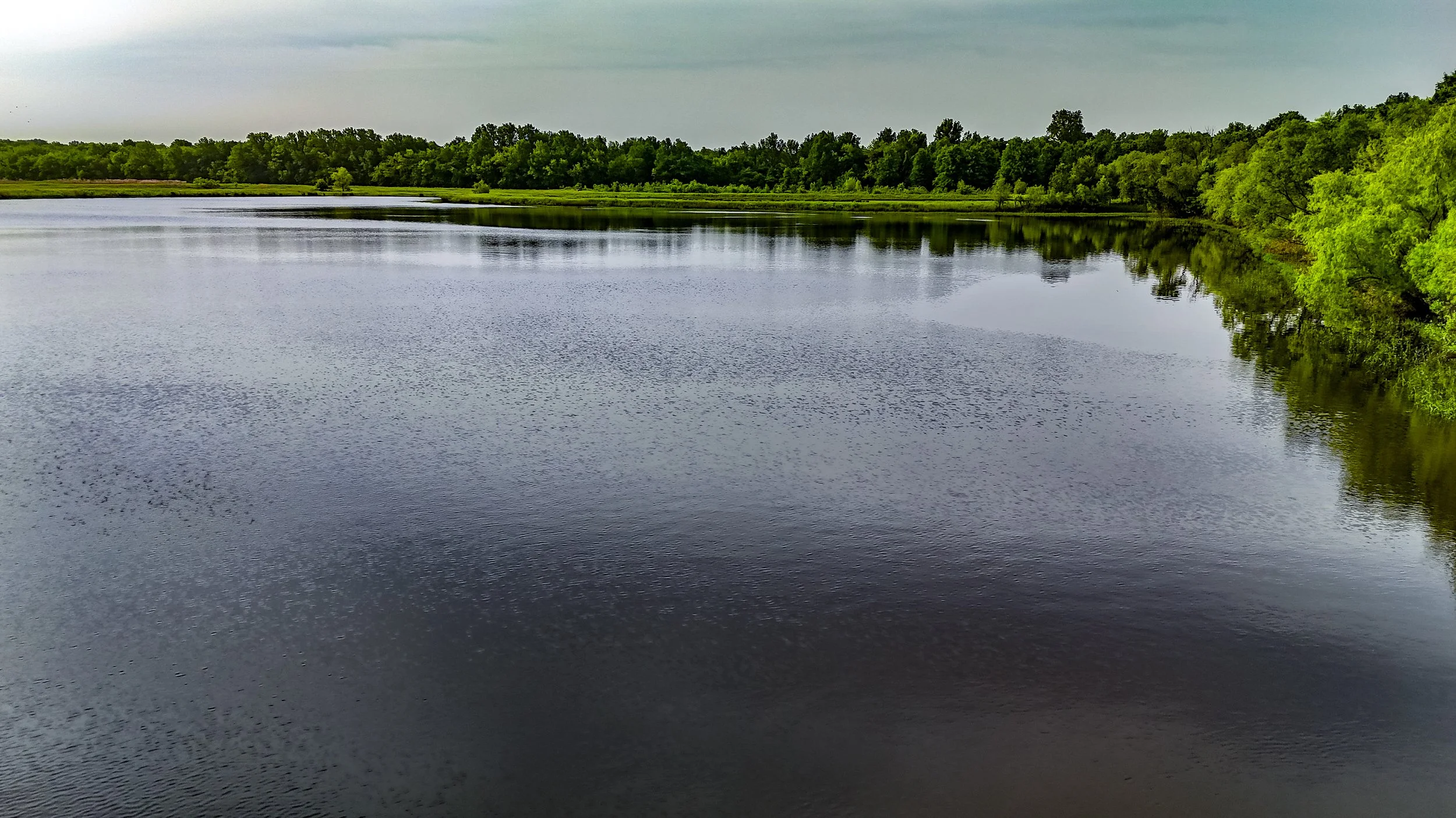
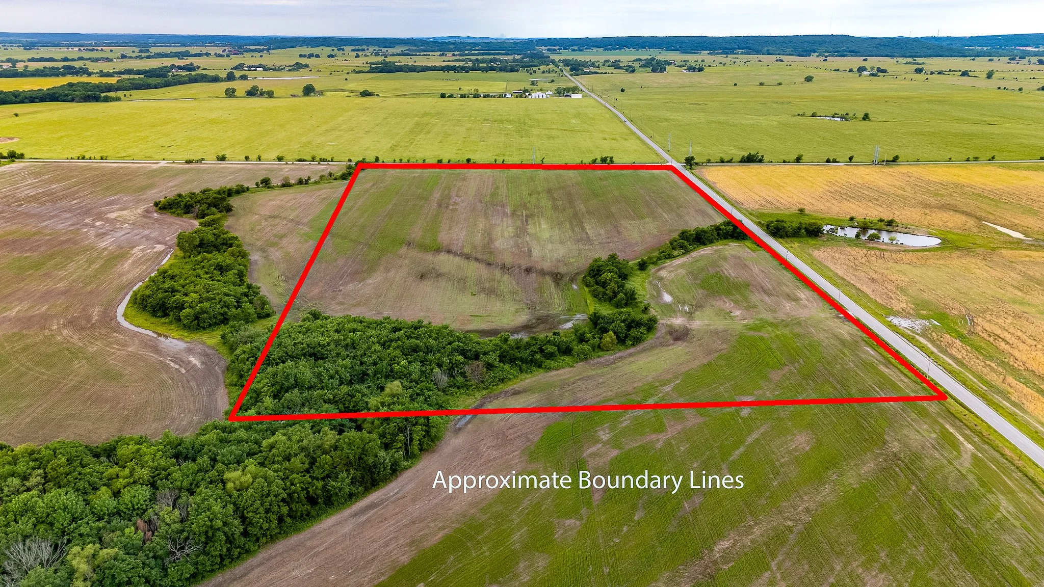
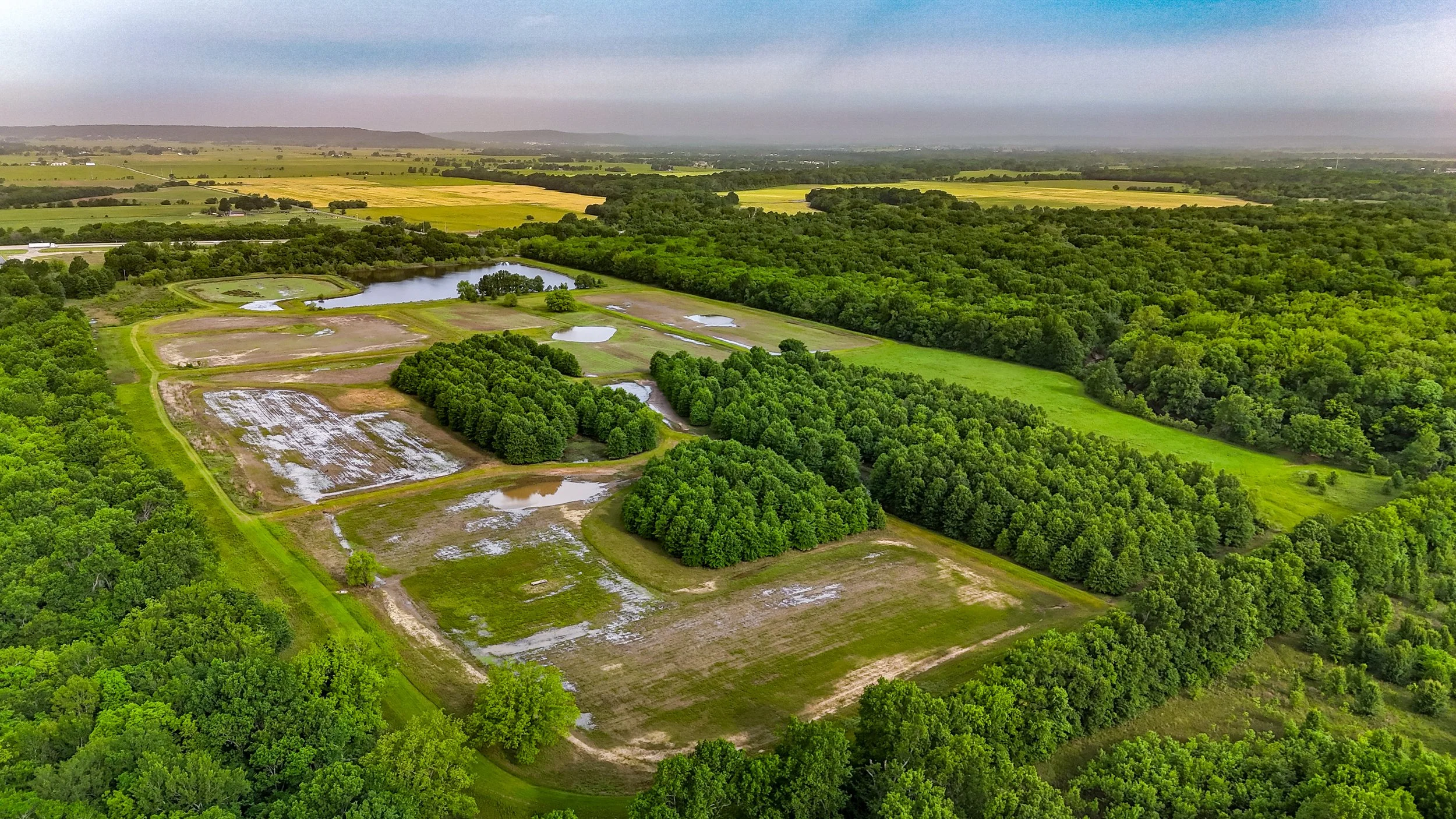
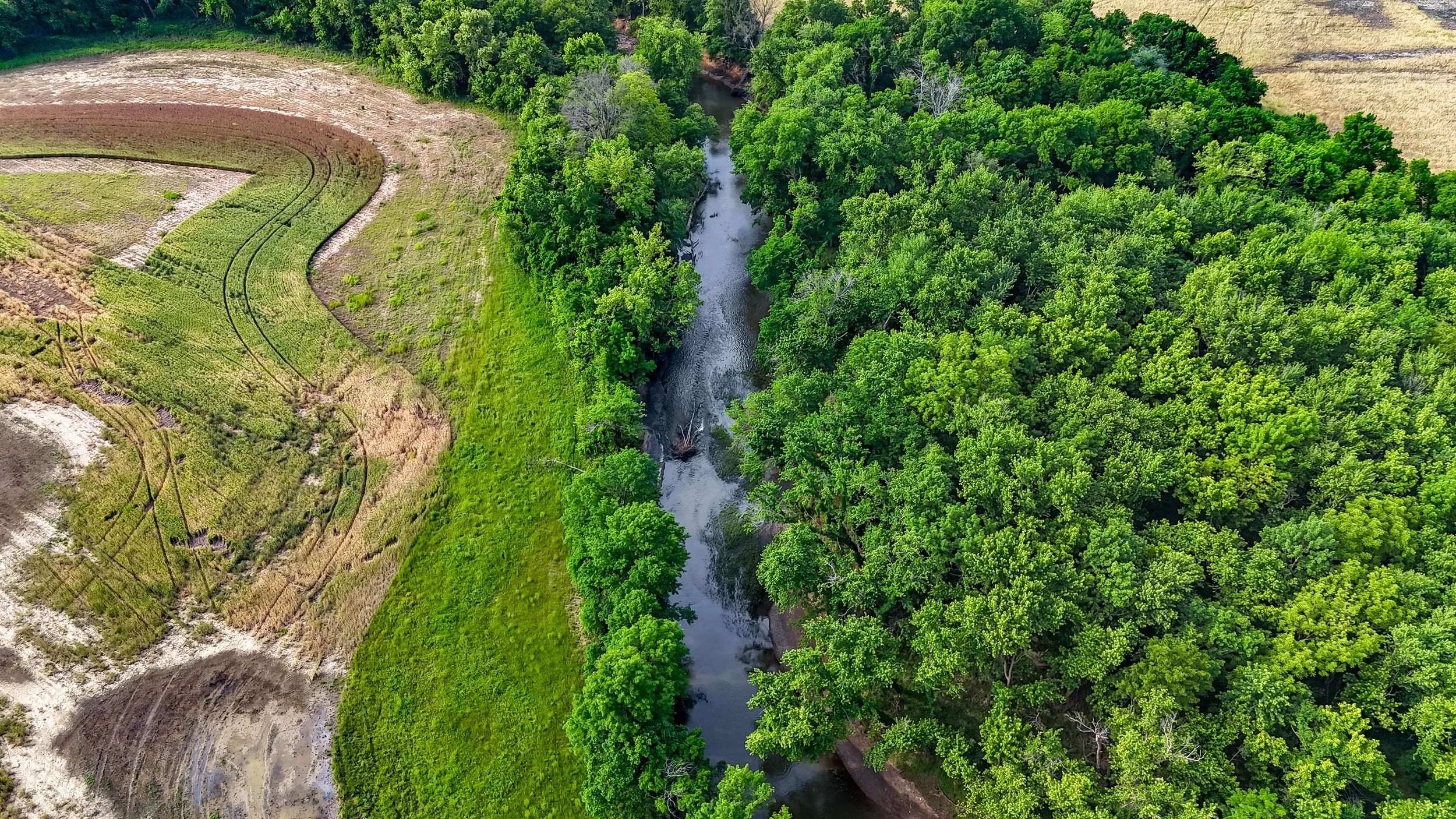
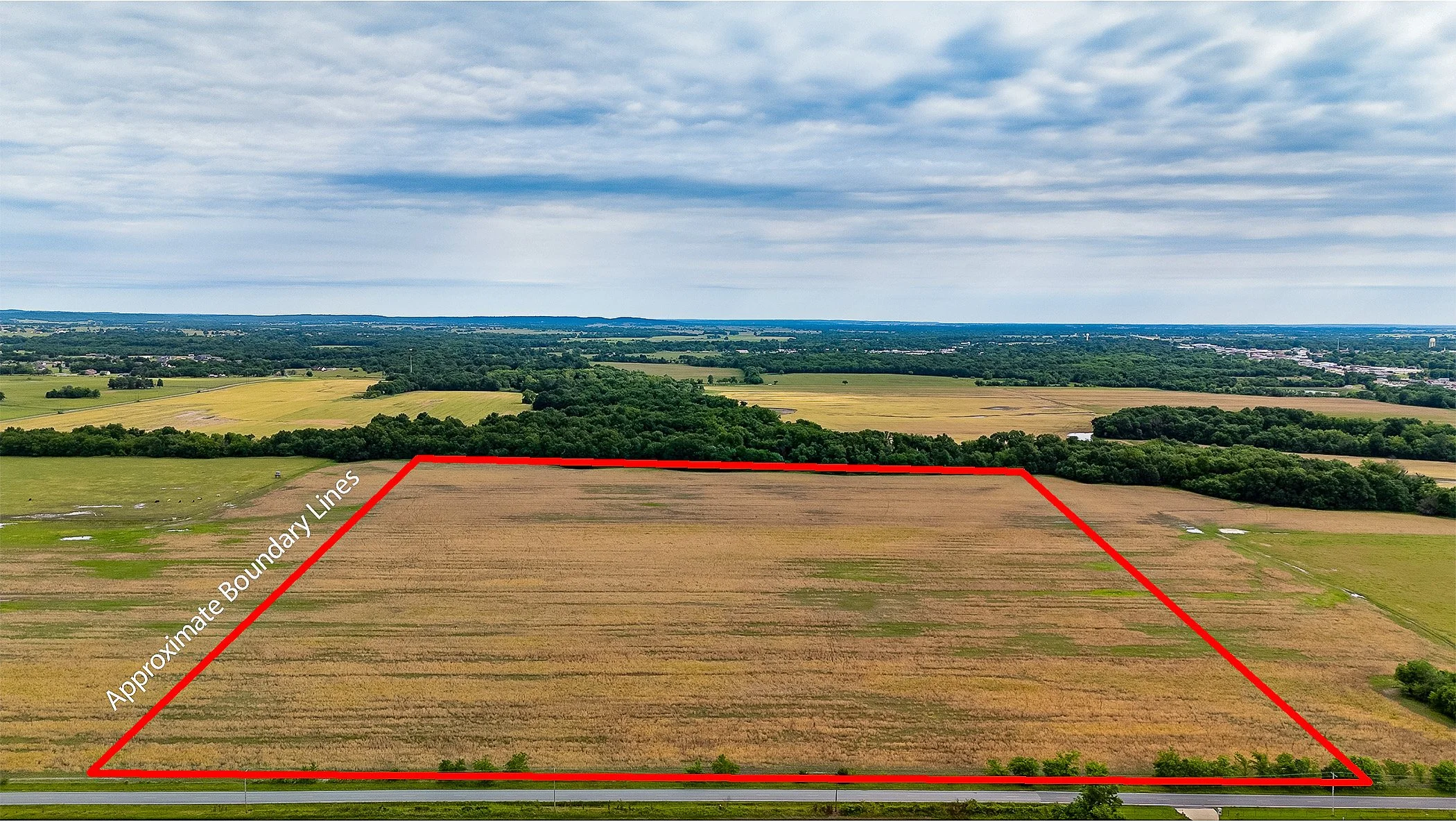
First impressions matter, and nothing captures the scale and beauty of a land listing like a bird's-eye view. Our professional aerial photography highlights the full scope of your property — from boundary lines and terrain features to water, timber, and buildable areas — giving buyers the visual context they need to fall in love before they ever set foot on the land.
Every image is professionally edited and delivered ready for MLS, social media, and marketing materials, ensuring your listing stands out in a crowded market.
Pricing by Acreage:
0 – 19 acres | $120
20 – 79 acres | $145
80 – 159 acres | $175
160 – 319 acres | $225
320 – 399 acres | $250
400+ acres | $350
All flights are performed by FAA Part 107 certified drone pilots, meeting federal safety and airspace regulations on every shoot — giving you and your clients complete peace of mind.
From small hobby farms to expansive rural tracts, we bring the same level of professionalism and precision to every property we fly.
Cinematic Aerial Land Tours — Make Your Listing Impossible to Ignore
Give buyers the full picture — from above. Our cinematic aerial video tours showcase your land listing in stunning, sweeping detail, giving buyers a true sense of scale, terrain, and possibility that ground-level photos simply can't deliver. Every tour is professionally edited into a captivating video up to 3 minutes long, designed to stop the scroll and drive serious inquiries.
Pricing by Acreage:
0 – 79 acres | $180
80 – 159 acres | $225
160 – 319 acres | $260
320 – 399 acres | $325
400+ acres | $450
All aerial tours are conducted by FAA Part 107 certified drone pilots, ensuring every flight meets federal safety and regulatory standards — so you can list with confidence.
Whether it's rolling pasture, wooded acreage, or agricultural land, we capture it all with the precision and visual impact your listing deserves.
A captivating 30-second drone video makes your listing stand out fast—showcasing the property’s best angles, lot layout, and surroundings to grab attention and drive more showings. $125 no acreage restrictions